coast defense

Masthead Image

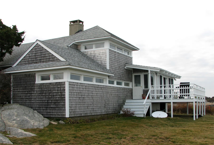
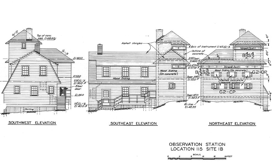
Strawberry Point: Fire Control Cottages

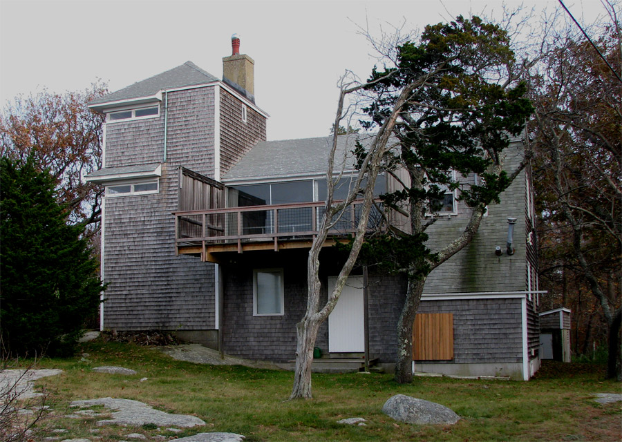
Low-profile, 2- and 3-story fire control structures, also called cottages, were built at several places along the coast, including Castle Hill (the Crane Estate), East Point (Nahant), Ft. Dawes (Deer Island), and here at Strawberry Point. The two cottages here are the only surviving examples; they probably owe their longevity to the unique ownership situation of the Glades Corporation (both before and after the war) and the fact that both structures were converted to residential use (as actual summer cottages--go figure). In any case, the two cottages today likely look much as they did when they were built in 1943.

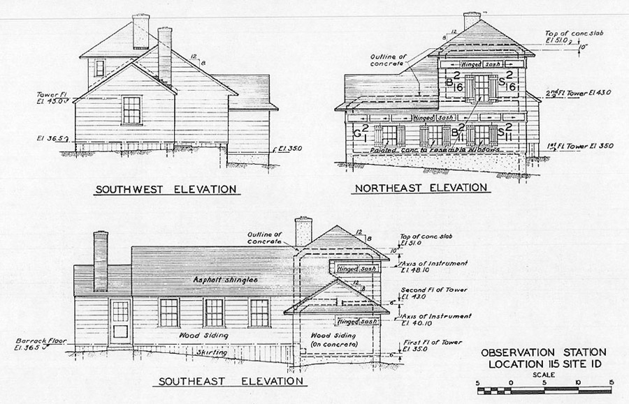
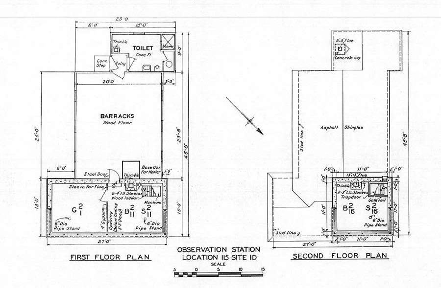
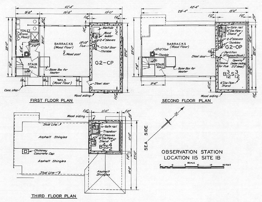
The Eastern Cottage (Site 1D) is located here, almost at the tip of the northeast promontory of the peninsula, at the end of a driveway from Glades Rd. running east along the shore. The elevation drawing in Silde 2 shows how the reinforced concrete shell of the fire control structure was hidden inside the wooden roof and the false siding and windows of the cottage. The "tower" portion of the structure was built on a 13x13 ft. plan, a bit smaller than the 14x14 ft. plan of one of the taller fire control towers along the coast (or here at Site 1A).

This cottage


The Cottages

  • Strawberry-Pt-Site-115-1D
    This fire control cottage sits near the ocean on the northeast extremity of Strawberry Point. The photo looks northwesterly. The shed over the back door and also the attached deck have been added since the war. The orange stake in the brush at the right edge of the image indicates the location of a steel geodetic disk (MY0087) set in 1943 in an exposure of ledge as part of the survey for the cottage's observing instruments. (PG 2009)
  • 115-1D-Elevations
    These elevation drawings by the US Corps of Engineers show the construction of the cottage, which wrapped wooden siding (and fake windows and shutters) around the concrete shell of the 2-story fire control structure and attached a wooden barracks. The slit-like observation windows and their hinged sash were exactly like those in the tall fire control towers.
  • 115-1D-Floor-Plans
    These US Corps of Engineers plans show the dual-bay observation post on the 1st floor and the single base end/spotting station on the 2nd floor. The exterior dimensions of this tower are 13x13 ft., while the tall towers' (including Site 1A here) are generally 14x14 ft. The cottage had flush toilets and likely steam heat from oil.
  • 1B-Photo-2009
    This photo looks southeasterly from Glades Road toward the Western Cottage. Like the Eastern Cottage, this one has had a number of post-war modifications, including the addition of a set of full-height picture windows and a deck midway up the former barracks wall. (PG 2009)
  • 1B-Elevations
    These elevation drawings by the US Corps of Engineers show the details of the cottage. Note that the first floor of the tower containing the Command Post (CP) for the G2 gun battalion has no observation slits. The windows indicated on the drawing are fake ones (to camouflage the building), covering muc smaller window openings that simply admitted light.
  • 1B-Plans
    Again, the first of the three stories of the tower had solid walls (with a few 1-foot indows) and holds a gun battalion command post, not an observation station. And as with the Eastern Cottage, the external dimensions of the top-level tower are 13x13 ft. (US Corps of Engineers)