Marshfield
Marshfield, about 25 miles southeast of the State House, has inherited the distinction of having the southernmost sites in the harbor defenses of Boston. During the WW2 era, the "southernmost" title was held by the 5-story fire control tower at Gurnet Point, about 10 miles further to the southeast, on Plymouth Bay. But after the war, the Gurnet Point tower was razed, leaving the "southernmost" title to the Brant Rock fire control tower in Marshfield.
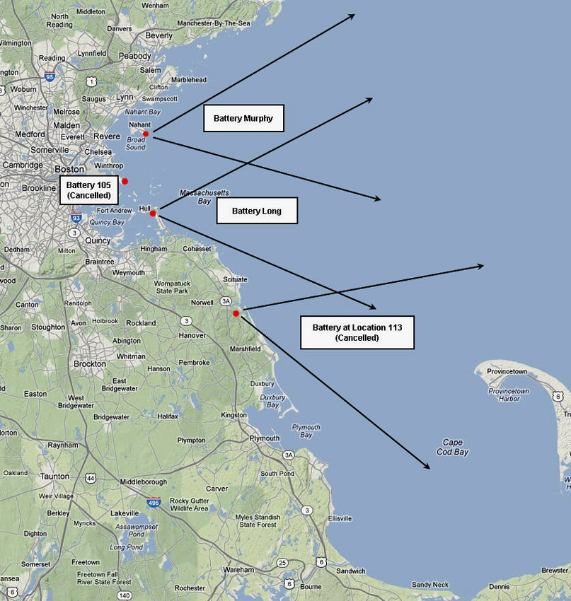
At the northern end of Marshfield lies the Fourth Cliff Reservation, which during the war received several new assets: a battery of two modern 6-inch guns (Battery 208), plus two fire control towers, a 5-story tower right at the northern tip of the reservation, and a 3-story "tower-in-a-house" further south on the peninsula. At 48 acres, the Fourth Cliff Reservation was larger than several other areas in the Boston defenses which were formally designated as "forts." It had been used by the Navy as a communications site prior to the war, and was acquired by the Army in 1942. After the war, it was assigned to the Air Force, used for communications and radar experiments, and later assumed its present role as a vacation spot for military personnel and their familes.
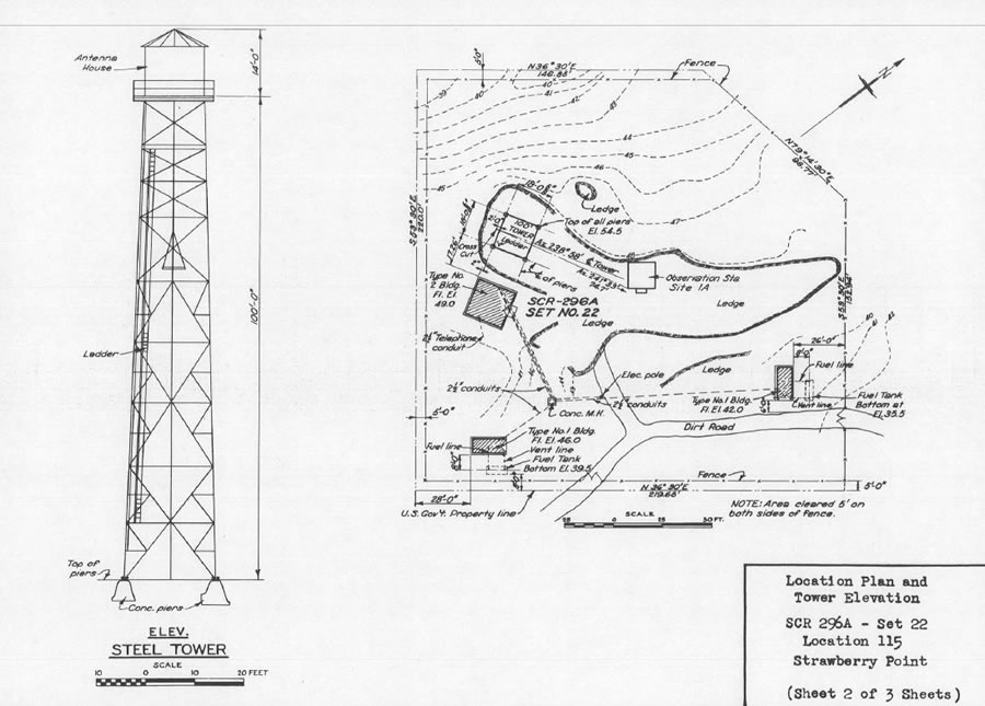
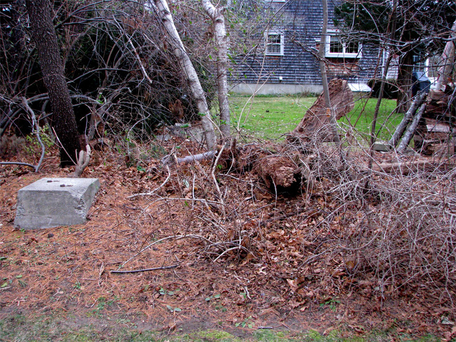
Marshfield was also the location of a WW2-era SCR-296 fire control radar, built atop Holly Hill (about 4000 ft. west of the beachfront in Humarock). With its antenna atop a 100-foot steel tower, this radar provided target detection and fire control data for the guns of Battery 208 at Fourth Cliff, and was one of nine such radars in the Boston system. [The northernmost SCR-296 radar was at Location 133, Gales Point, in Manchester.] The footings of the tower still survive, obscured by brush and lawn debris in a Marshfield back yard.
Clicking on any of the panels above will provide detail on the Marshfield sites. Click again to minimize each panel.
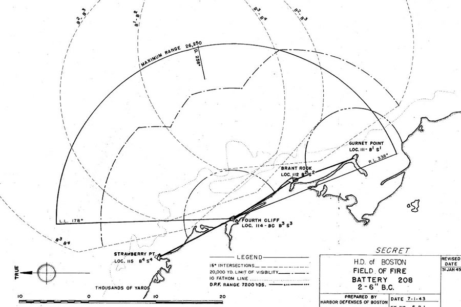
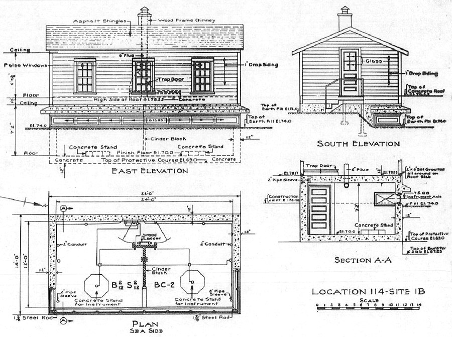
Completed on October 1, 1943 and turned over to the Army more than a year later (November 9, 1944), , Battery 208 barely made it into service before the war ended. It was was located at Fourth Cliff's Site 1-B (see Slide 1 at left) and was laid out on the same plan as the 6-inch Battery 206 at Nahant. [Battery Jewell, the 6-inch battery on Outer Brewster Island that was to have been named Battery 209, was similar in most respects.]. There would have been a fourth such battery, Battery 207 at Fort Dawes, but it was cancelled before the end of the war.
Battery 208 mounted two 6-inch Model T2 guns on M4-BC carriages, and its construction cost a total of $334,000. Its two guns were mounted (trunnion elevation) about 60 feet above sea level.
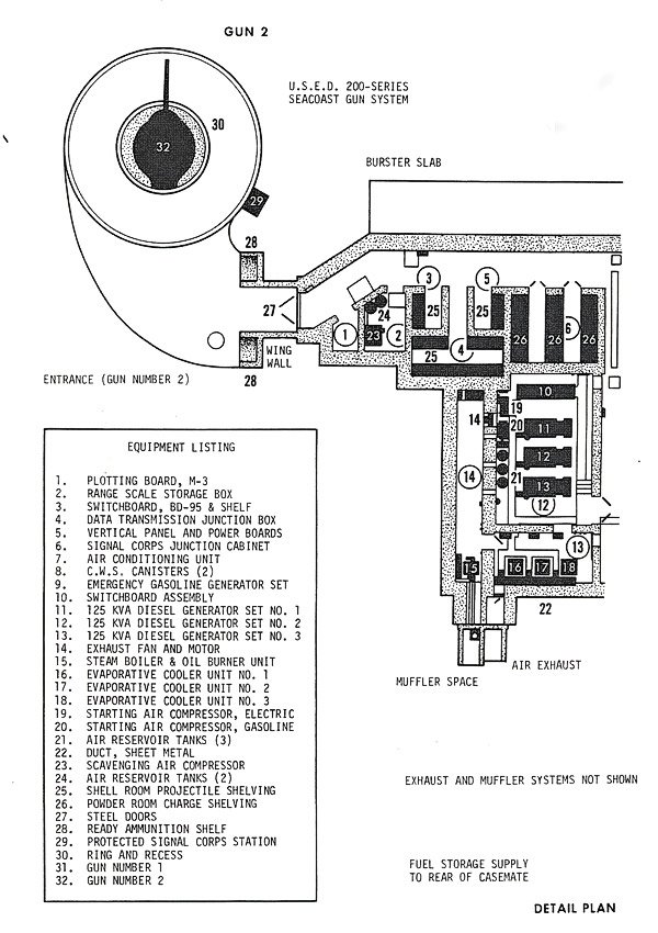
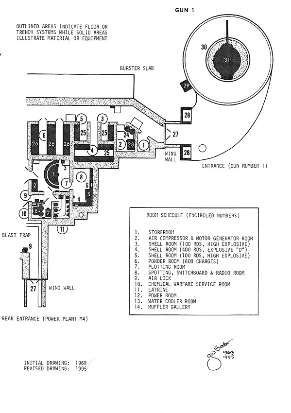
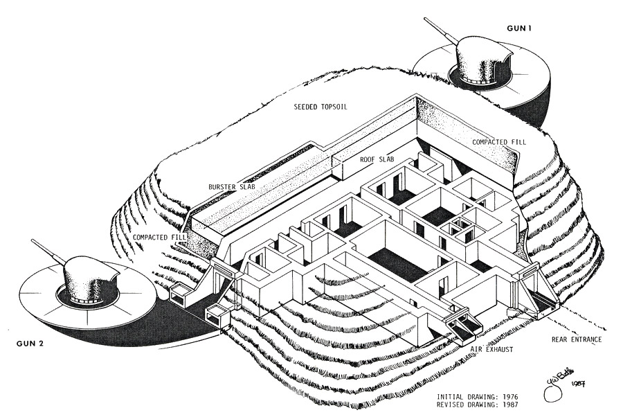
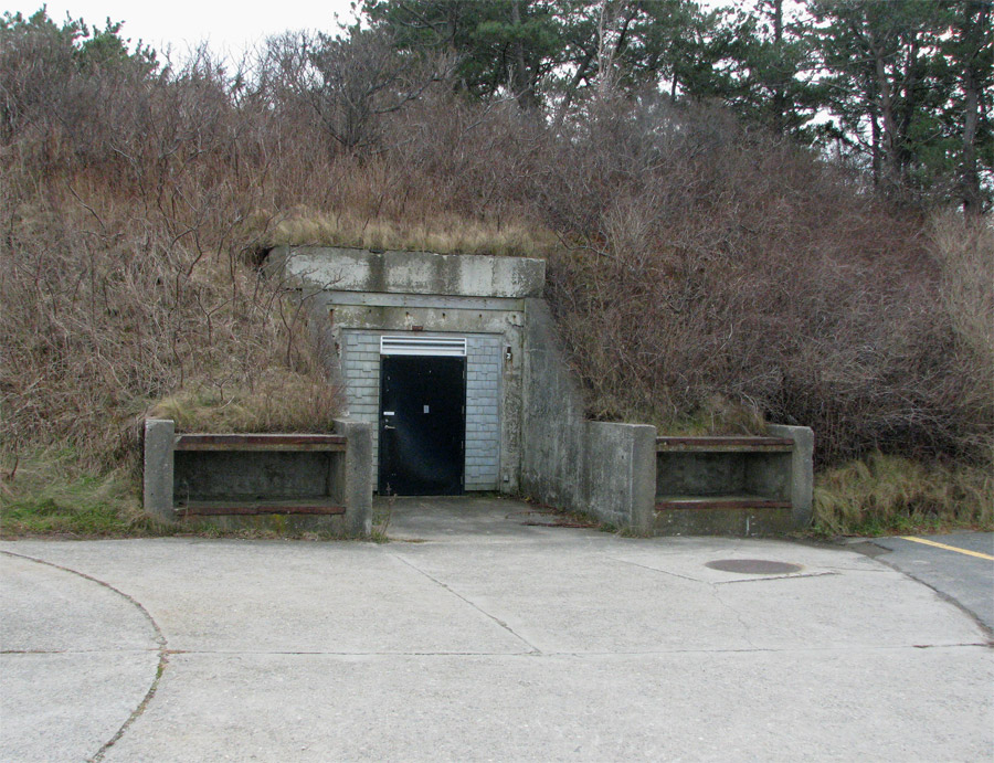
A cutaway drawing in Slide 5 at left ilustrates the design of the reinforced concrete casemate that lies beneath the earthen mound at Fourth Cliff, and Slides 3 and 4 detail its rooms and equipment. Reportedly, the original motors and generators that supplied power for the guns are still within the equipment bunkers, which are secured behind heavy steel doors. The ammunitionn ready alcoves serving both guns, however, are easily visible (Slide 9).
Battery 208 contained an unusual feature--a concrete fire control bunker, with a small wooden shed-like structure built on its roof as camouflage (Slides 6-8). This bunker, which could be reached by ladder from the magazines below, was 12 x 24 ft. in size, the usual dimensions for such structures. It was designed to hold two observation stations: a Battery Commander's station for Battery 208 and a BES for the 16-inch guns at Fort Dawes (Construction 105, cancelled before completion).
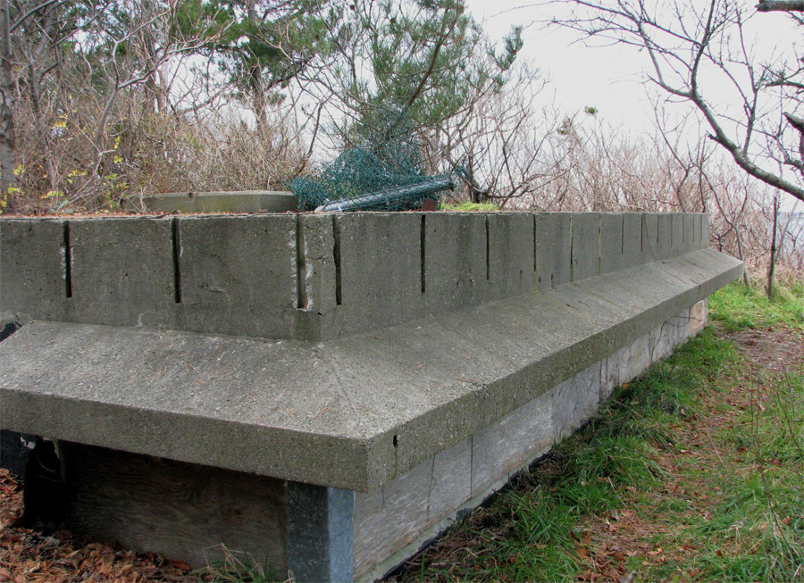
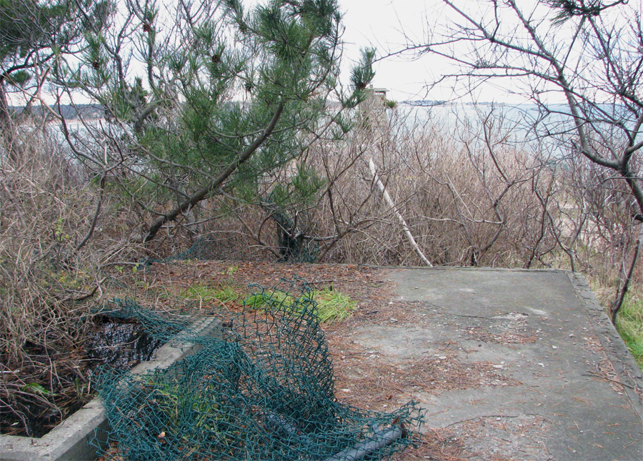
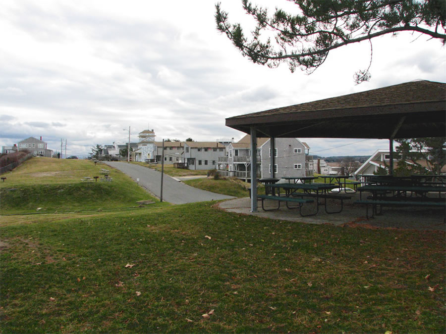
Today. the battery looks like an inviting picnic site. The platform for Gun 1 has been covered with a wooden pavillion which shelters the picnic tables beneath it (Slide 10). Gun 2, on the other (north) side of the magazines, has become a couple of reserved sites for camping trailers (Slide 9).
There were two fire control towers at Fourth Cliff, and both of these have survived.
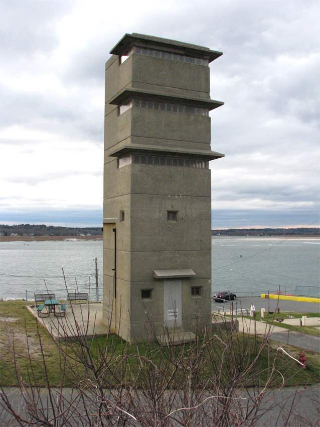
The 5-story tower at the northern tip of the peninsula, at Location 114/Site 1-D, is shown in Slide 13. This tower was completed on April 2, 1943 and originally had a 31 foot-square wooden barracks building attached to its western side, but all that remains of these crew quarters is the concrete foundation pad (see photo).
In its top story (with an instrument height above sea level of 83 fee) the tower had a base end station (BES #3) for nearby Battery 208 (see Slide X). The fourth story, at 75 feet) housed BES #2 for Battery Long, the 16-inch guns in Hull, and the third story was a spare.
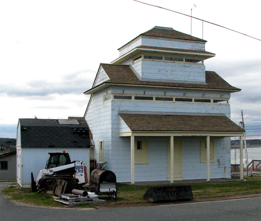
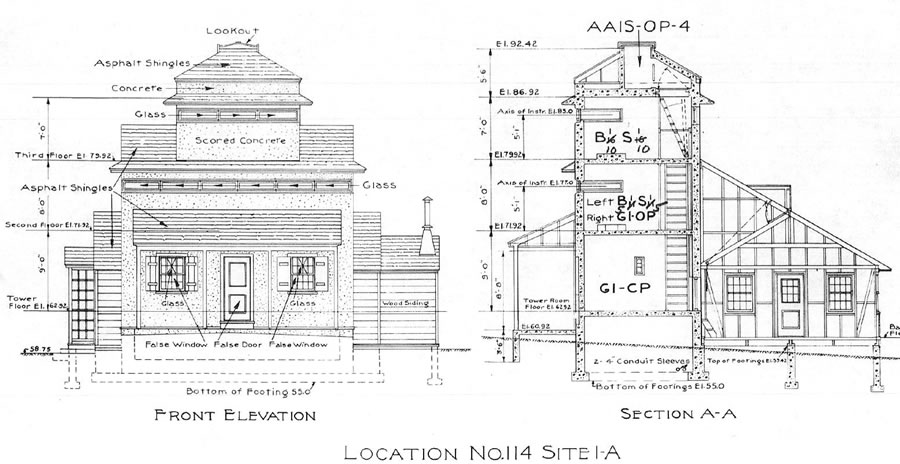
The other fire control tower at Fourth Cliff was the "tower-in-a-house" at Site 1-A, near the southern end of the reservation (Slides 11 and 12). This 3-story tower, completed on November 6, 1943, camouflaged to resemble a shorefront cottage, contained several observation stations. On the third floor (equipped with a DPF instrument) was BES #1 (B1/S1) for the 16-inch guns of Battery Murphy at East Point in Nahant. Beneath this, the second floor contained two stations, each with a DPF instrument. On the right (looking seaward) was BES #1 for the 6-inch guns of Battery Jewell on Outer Brewster Island. On the left was the OP for the G-1 command (which controlled the southern group of guns protecting the harbor). The command post (CP) for the G-1 command occupied the entire first floor of the tower. The tower itself was accessed through a door from the 16-man rectangular (20 x 32 ft.) wooden barracks building that was attached to the west (inland) side of the tower.
The antiaircraft (AAIS) spotting station (OP-3 in the system, which started at Halibut Point in the north and ran down to Gurnet Point in the south) occupied the cupola atop the 3-story tower, reached by climbing a ladder from the third story and then popping open a hatch to the roof.
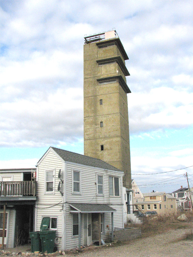
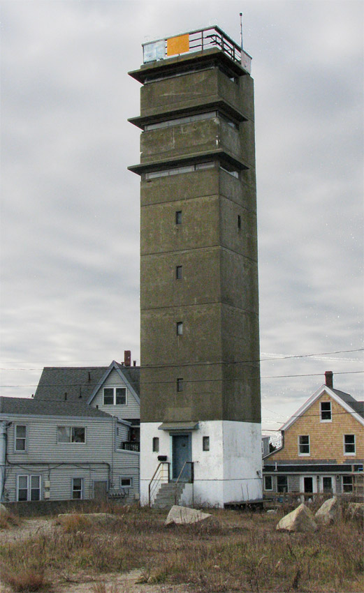
This 8-story fire control tower (Location 112) is one of four that were built around Boston during the WW2-era, all of which have survived to the present. Completed on May 29, 1943, it is the lowest of the 8-story towers and certainly the most conspicuous (the other three 8-story towers are set back considerably from the shore or are somewhat concealed by surrounding topography and vegitation). The Brant Rock tower even now sticks out like a sore thumb from the beachfront cottages that surround it, and in 1942, it must have been evven more obtrusive.
Although the RCW Form 2 for this tower is a little ambiguous, it appears that the tower was originally intended to house three BESs on its upper three stories: BES #1 for the 16-inch guns at Battery Long in Hull on the top level, BES #1 for the 16-inch guns at Fort Dawes (later cancelled) on the 7th story, and BES #3 for Battery 208 at Fourth Cliff on the 6th story. It is not clear whether Battery 208's station moved up a level after the cancellation. There was also an AAIS observation post on the top level, with a trapdoor through the roof.
SCR-296a radars were used to track targets and send azimuth and range information to coast artillery batteries. These early radars, which were put in place nb the first years of WW2, were essentially the same sets as those in Navy FC shipboard radars. An SCR-296a emplacement included three small buildings (an operators' building and two buildings for electric generators), plus buried fuel tanks and piping to carry fuel to the generators. The antennas were camouflaged inside peaked cylindrical enclosures that resembled tall water towers.
The Holly Hill set (Location 112A) had Battery 208 at Fourth Cliff as the primary battery it was to spot for. This was one of nine SCR-296a sets that were eventually built to ring Boston during the war and supported gun batteries of 6-inch caliber or larger.
The SCR-296a radar was generally thought to be effective in locating targets at ranges of between 20,000 to 40,000 yards, but it had a very narrow beam, only 9 degrees in azimuth. In practice, that meant operators of an SCR-296a had to be "tipped off" to the presence of ship targets by one of the more sensitive search radars in the harbor defenses (e.g., the SCR-582 at the HDCP). Also, if enemy ships were closer together than about 250 yards, an SCR-296a could often not distinguish between their blips. But once they were locked onto a target, the crew of the radar could pass azimuth and range data to the guns.
The original WW2-era Modernization Program included construction of a fourth battery of massive 16-inch guns at "Flowers Hill," Location 113. Assuming this was Flower Hill in Marshfield (and both Locations 112 and 114 lay in that town) the guns would have been located about a mile and a half southwest of Fourth Cliff, just east of Summer Street (see map in Slide 16). From this position, the guns' 25-mile range would have reached as far as Provincetown or Sandwich on Cape Cod, and about five miles further east of Boston than the guns of Battery Long. But by 1942, however, it seemed clear to planners that no heavy surface naval forces were likely to threaten Boston during WW2, so the Marshfield 16-innh battery was cancelled before even land acquistion took place.